Corps Monitoring Solution Capabilities
Crop Growth Monitoring
A built-in set of vegetation indices such as NDVI make users keep a constant eye on crops and monitor their development, which is the basis of agricultural activities.
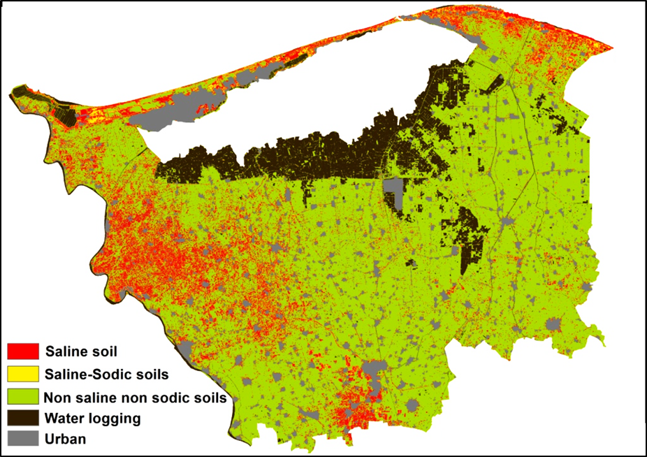
Soil Data Analytics
There are about five soil indices to help you analyze the soil moisture and the soil salt content. You can choose to water and fertilize depending on the condition of the soil.
Yield Data Analytics
The yield data could assist you in assessment of potential yield and soil nutrient which can be converted to a variable rate application map and used for decisions such as fertilizer application.
Meteorology Monitoring
Knowing the weather patterns is the key to a good harvest. Our products can use temperature and accumulated precipitation information to identify growth stages and help plan activities.
Disaster Warnings
The system provides notifications which will pop up when abnormal conditions are detected. Moreover, the system locate the disaster zone with longitude and altitude info on the map.
Zoning Decision-making
Depending on the value of the index, the field will be intelligently zoned and you can input different amounts of fertilizer to different conditions of the soil or crop to save money and achieve higher yields.
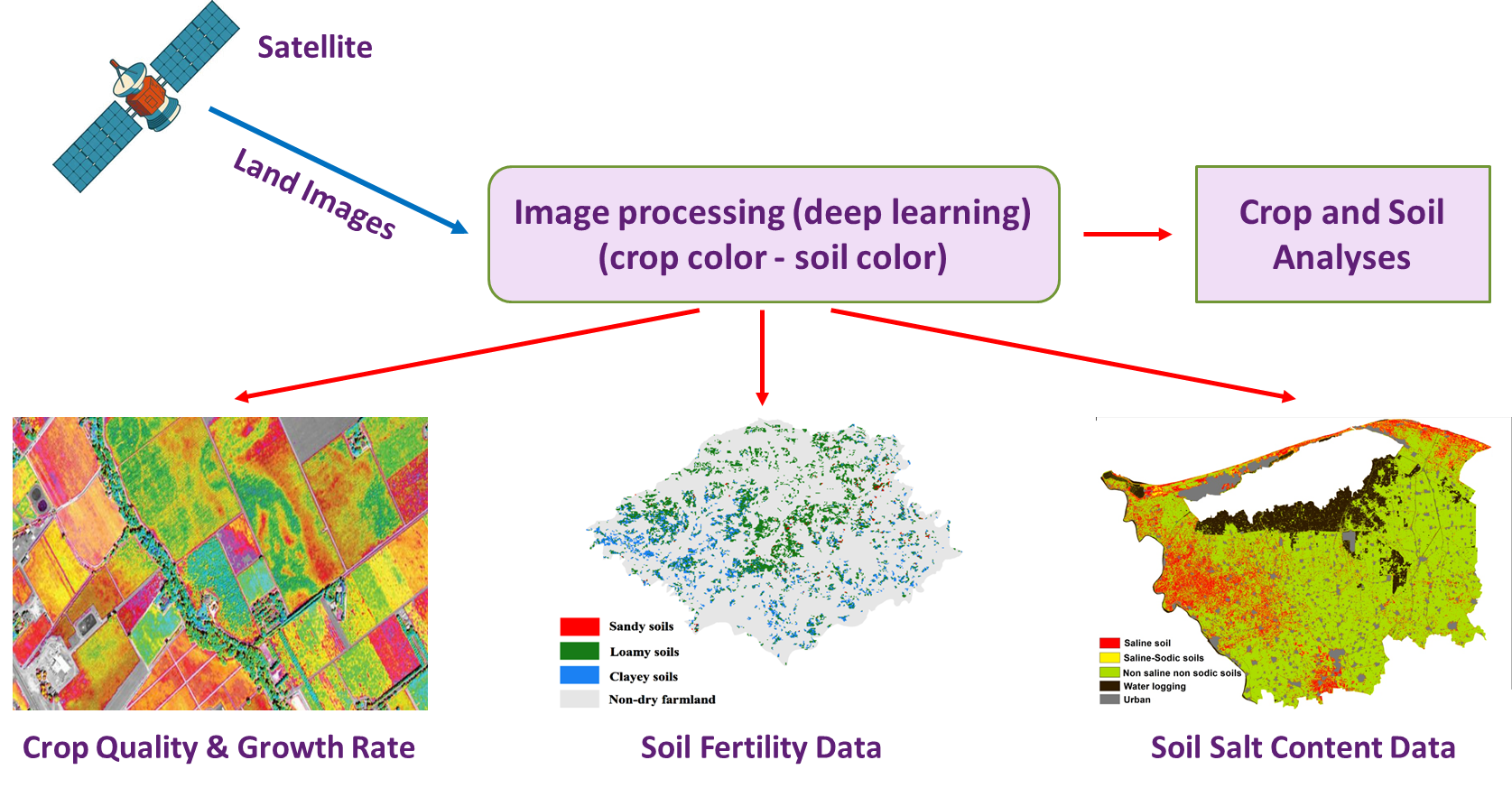
Corps Monitoring Solution Architecture
Corps Monitoring Solution Features
- The system processes satellite images and provides the analyzes required to determine crop growth, follow up on the development of agricultural projects, detect encroachment on agricultural land, and follow up on the phenomenon of desertification and the rate of its impact.
- The system uses raw data from recent satellite images, color analysis, and other necessary parameters on a periodic basis according to the nature of the area to be monitored (weekly - monthly - ... etc.) in order to detect changes during that period.
- The system uses artificial intelligence (Deep Learning) techniques to calculate the rates of implementation of national agricultural projects, predict the timing of completion of their stages, and provide accurate reports on the progress of the projects and the quality of the crops that have been grown.
Countries
Users
Distributors
Years